FAQ: Is There a Universal Difficulty Rating System for OHV Trails?
Generally there are no difficulty ratings for OHV trails.
by
American Trails Staff
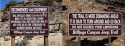
Billings Canyon Jeep Trail in Colorado posts extreme route warning signs; photo BLM Colorado State Office
Billings Canyon Jeep Trail in Colorado posts extreme route warning signs; photo BLM Colorado State Office
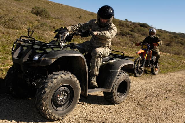
Difficulty ratings are very subjective and would be different for each type of OHV. A trail that is easy for an experienced driver with a highly modified vehicle may be impassable for a novice driver in a stock vehicle.
Here are two types of rating systems used throughout the United States:
Color Symbols
The Hungry Valley State Vehicular Recreation Area in Gorman, California has more than 100 miles of trails that have been assigned skill ratings for the three primary types of vehicles commonly used: motorcycles, ATVs and 4-wheel drives. Signs with colored symbols indicating the trail difficulty and one-way trails are posted at each trailhead.
The trail rating guide system takes into consideration the trail width, the steepness and the trail surface composition. The ratings are intended to be guides to make trail use easier, and to encourage you to assess your own capabilities before venturing out on any trail. Use the trail rating guide when planning your route. Trails are marked to indicate the expertise needed to drive the trail under normal conditions. At times, wet weather conditions can significantly increase the difficulty of some trails.
The Minnesota Department of Natural Resources also assigns skill ratings based on colored symbols.
Symbols are similar to ski area ratings:
Green circle (easiest)
- Most highly-developed class of trails (almost road like) with no steep hills and few obstacles.
- Intended for novice riders who have mastered the basic skills necessary for safe operation on well-developed trails.
- Also for those lacking the experience or desire to ride more difficult trails.
- Approximately 10% of trails in the system should be classified as "easiest."
Blue square (more difficult)
- Suitable for the majority of intermediate riders.
- More difficult trails are narrower with steeper hills and switchbacks and some moderate obstacles.
- Intended for OHV enthusiasts with well-developed skills seeking a reasonably challenging trail ride.
- Riders subjected to higher degree of risk and exposure.
- Approximately 80% of trails in the system should be classified as "more difficult."
Black diamond (most difficult)
- Most primitive class of trails requiring a high-level of skill and experience.
- Very steep grades, narrow trails, sharp alignments, rough or loose tread surfaces, and substantial obstacles.
- Suitable only for proficient or expert riders to test their machines—and their own skills and abilities.
- Approximately 10% of trails in the system should be classified as "most difficult."
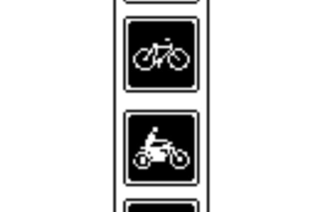
Orange blazed (single-track motorcycle)
- Limited to motorcycle trails.
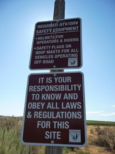
Safety sign in Juniper Dunes Wilderness and OHV Area, Washington; photo BLM Spokane District Office
Numerical Rating System
The Colorado Association of 4 Wheel Drive Clubs, Inc. uses a numerical rating system from 1 through 10. This system has been adopted by many other states:
- Graded dirt road. Dry, or less than 3" water crossing depth. Gentle grades. 2WD under all conditions except snow. No width problems, two vehicles wide.
- Dirt road. Dry, or less than 3" water crossing depth. Some ruts. Slight grades, up to 10 degrees. 2WD under most conditions. Rain or snow may make 4WD necessary. Usually one and a half to two vehicles wide.
- Dirt road. Rutted, washes, or gulches. Water crossings up to 6" depth. Passable mud. Grades up to 10 degrees. Small rocks or holes. 4WD recommended but 2WD possible under good conditions and with adequate ground clearance and skill. No width problems for any normal vehicle. Vehicle passing spots frequently available if less than two vehicles wide.
- Rutted and/or rocky road. No shelves but rocks to 9". Water crossings usually less than hub deep. Passable mud. Grades moderate, up to 15 degrees. Side hill moderate up to 15 degrees. 4WD under most conditions. No width problems, vehicle passing spots frequently available if less than two vehicles wide.
- Rutted and/or rocky road. No shelves. Rocks up to 12" and water crossings up to 12" with possible currents. Passable mud. Moderate grades to 15 degrees. 6" holes. Side hill to 20 degrees. 4WD required. No width problems.
- Quite rocky or deep ruts. Rocks to 12" and frequent. Water crossings may exceed hub depth with strong currents. Shelves to 6". Mud may require checking before proceeding. Moderate grades to 20 degrees. Sidehill may approach 30 degrees. 4WD necessary and second attempts may be required with stock vehicles. Caution may be required with wider vehicles.
- Rocks frequent and large, 12" and may exceed hub height. Holes frequent or deep (12"). Shelves to 9". Mud 8" deep and may be present on uphill sections. Grades to 25 degrees and sidehill to 30 degrees. Water crossings to 18" and may have strong currents. 1-1/2 vehicles wide. 4WD required. Driver experience helpful.
- Heavy rock and/or severe ruts. Rocks exceeding hub height frequent. Shelves to 12". Deep mud or uphill mud sections. Steep grades to 25 degrees and can be loose or rocky. Water crossings may exceed 30" in depth. Side hill to 30 degrees. One vehicle wide. Body damage possible. Experience needed. Vehicle Modifications helpful.
- Severe rock over 15". Frequent deep holes over 15". Shelves over 15". Mud bog conditions (long, deep, no firm bottom). Over 30" water crossings with strong currents. Steep grades over 30 degrees. Sidehill over 30 degrees. May not be passable by stock vehicles. Experience essential. Body damage, mechanical breakdown, rollover probable. Extreme caution required.
- Severe conditions. Extreme caution recommended. Impassable by stock vehicles. Winching required. Trail building necessary. May be impassable. Impassable under anything but ideal conditions. Vehicle damage probable. Personal injury possible. Extreme caution necessary.
Changing Trail Conditions
Weather conditions may also significantly affect the difficulty of a trail. Also, the difficulty of a trail may change over time, as trail use, weather, and maintenance modify the trail. Always check with the managing organization and/or recent users before planning a trip on a trail and scout ahead on foot if you are not sure of current conditions.
Rider Safety
The United States Consumer Product Safety Commission recommends these five tips:
- Stay off of paved roads
- Do not allow a child under 16 to drive or ride an adult ATV.
- Do not allow more people on the vehicle than it is designed to carry.
- Always wear a helmet and other protective gear such as eye protection, boots, gloves, long pants and a long-sleeved shirt.
- Take a hands-on safety training course.
Above all - always ride within your skill level!
Related Resources
Attached document published July 2014
16,516 views • posted 12/10/2019